
High moisture levels in the atmosphere, along with a weak frontal boundary, gave us a good round of scattered storms this afternoon. Storms moved slowly and were efficient rain producers, causing some street flooding in localized spots, especially near Lafayette and Breaux Bridge. Storms will continue through the evening hours, but should begin to dissipate after 9-10pm. High-resolution models show storms developing near the coast by the morning hours.
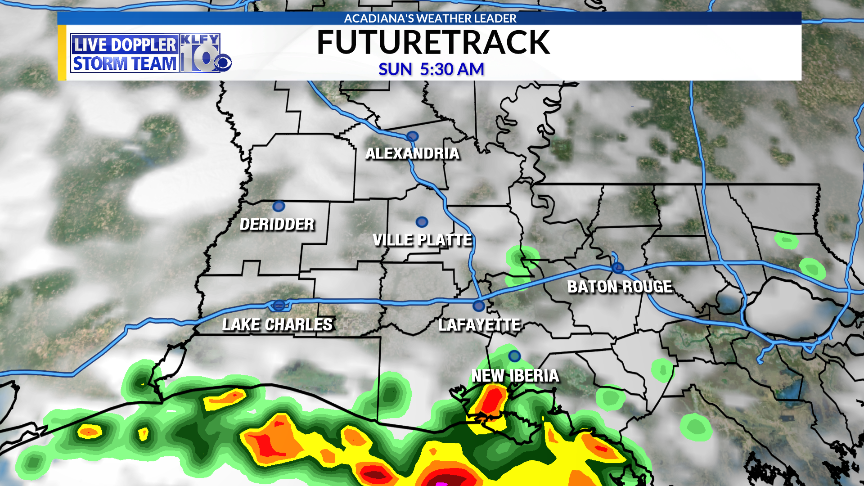
RPM Model 5:30am
In this type of pattern, when you have a stalled boundary in place, it is not uncommon to see stronger storms develop offshore during the morning hours, so we’ll be monitoring radar overnight. Storms that do form will move northward through mid-morning and the afternoon. Rain coverage should be near 50-60% with frequent cloud-to-ground lightning, heavy rainfall in localized spots, and gusty winds all possible.

RPM Model 3:30pm
We could managed to get a break, at least from the widespread rainfall, Monday and Tuesday as a ridge of high pressure tries to build in from the west. This is the same high pressure that has caused the record-breaking heat across the country, but it hasn’t been able to build in enough to shut down rain chances in our area. In fact, we’ve seen a parade of impulses rounding the high pressure and coming into our area from the east. This pattern looks to continue through next week. The next, stronger disturbance, looks to come in by mid-week, bringing high levels of moisture right back into the area. This will increase rain chances once again by Wednesday, Thursday, and Friday of next week. Hopefully, high pressure tries to build in again by next weekend, but it appears, at the very least, daily storm chances will remain through the entirety of the forecast.
TROPICAL UPDATE
Beryl has continued to lose structure today as shear and a faster forward speed is starting to take its toll on the system. It’s expected to move into the Lesser Antilles by Sunday night/Monday. Thereafter, dissipation is expected across the eastern Caribbean.

Tropical Depression #3 is still churning off the Carolina coast. Some strengthening is expected as it lifts northward and gets absorbed into a trough early next week. It currently poses no threat to land. If it were to acquire a name, it would be Chris.

~Meteorologist Trevor Sonnier
