
Tropics remain in overdrive with four active tropical cyclones across the Atlantic basin. We have Hurricane Florence, which will produce catastrophic effects for the eastern seaboard through the next 24-48 hours. We also have Tropical Storm Isaac, Hurricane Helene, Subtropical Storm Joyce, and a potential Gulf system.
POTENTIAL GULF SYSTEM….
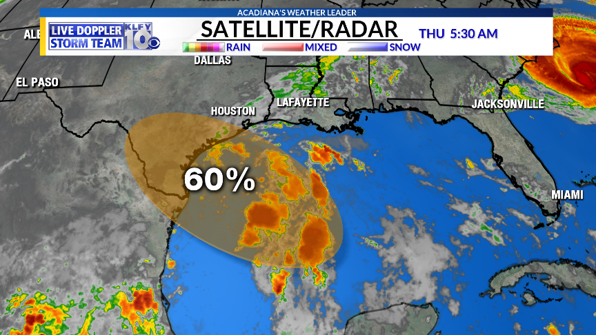
A broad tropical wave is moving into the western Gulf this morning. Atmospheric conditions could become slightly more conducive for some weak tropical development before it moves into the central Texas coast by tomorrow. Regardless of development, heavier rainfall will spread across Texas through the next few days, with rainfall totals of 2-5 inches possible from Brownsville to Galveston Texas. This system should have no effect on Acadiana.
HURRICANE FLORENCE…
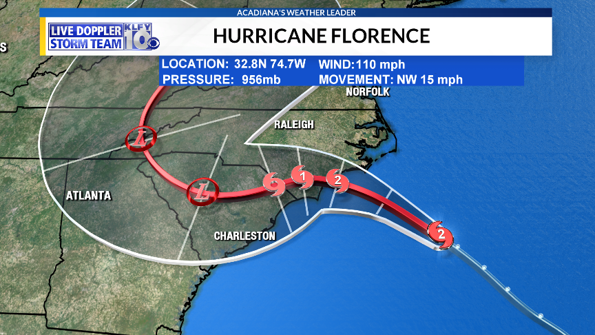
Southwesterly shear has impacted the system overnight, but it remains a very strong hurricane. A category two or three hurricane is expected at landfall tonight and tomorrow morning. The biggest threats with this system will include storm surge and inland flooding. The storm will slow down once approaching the coast, which will enhance storm surge effects, especially as water piles up along the coast with a large fetch (water traveling over a long distance). Storm surge of 8-13 feet will be possible. The water coming from the sky will also enhance the flooding as rainfall totals will exceed 20 inches across much of the south part of North Carolina.
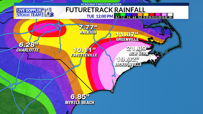
The global (low-resolution) GFS shows 20 inches, meaning rainfall totals in isolated spots of 25-30 inches will be possible.
TROPICAL STORM ISAAC
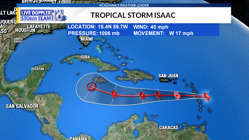
Isaac remains poorly organized this morning as westerly shear is impacting the system. The low-level circulation is displaced well to the west of the deep convection. Further weakening is expected as it moves westward through the Caribbean. There’s a decent chance that this storm will die off through the next 2-4 days. However, some models show more conducive conditions once it enters the western Caribbean later next week and if there’s enough of a storm left to take advantage, regeneration could be possible. For this reason, we should not take our eyes off of Isaac just yet.

The overnight European model actually redevelops the system south of Cuba by the end of next week. The last several runs of the GFS model kill the system.
JOYCE AND HELENE….
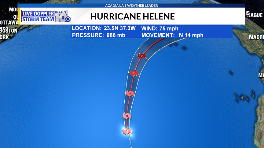
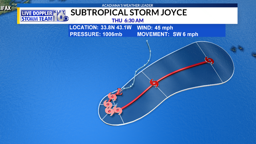
Both systems should continue to move northward over the opens waters of the Atlantic. Both systems will only affect maritime interests and are not a threat to land.
~Meteorologist Trevor Sonnier


