
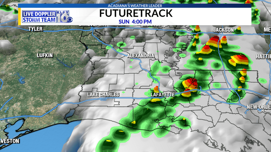
Still on track for a round of storms coming in for your Easter Sunday, some of which could be strong to severe.
A low pressure area will develop across north-central Texas on Sunday and slowly strengthen through the day as it moves eastward across the southeast U.S. This will locally enhance wind shear in the atmosphere with winds both turning and getting stronger with height. Meanwhile, as the daytime heating occurs, the temperature drop with height will become more impressive with warm air at the surface, heated by the sun, and cold air aloft. Remember, warm air likes to rise, so this aides in the development of thunderstorms and the stronger the warm air rise is, the stronger the storm is. This also aides in the development of hailstones that can grow larger due to upward winds keeping them in the cloud longer. Because of this reason, we’ll have to watch for large hail in discrete storms that form.
On top of large hail, the turning and strengthening winds will lead to rotating storms, so we’ll be watching for the development of tornadoes and damaging wind gusts.
There is one plus in all of this! Models showing the atmosphere have been pretty unanimous in showing a “cap” in the atmosphere through the day tomorrow. Storms usually need a steady temperature drop with height to keep the air rising and keep the storms healthy. A cap is a layer of warm air up above that can keep the air from rising, and thus make it harder for storms to form. Now this can work in a favor or work against us. If it works in our favor, it can keep storm development at a minimum and keep most of the severe activity further northward towards central Louisiana, Mississippi, and Alabama. It can also work against us by keeping storms more discrete, meaning more super-cell storms versus a messy storm complex. Super-cells are usually more capable of producing hail and tornadoes.
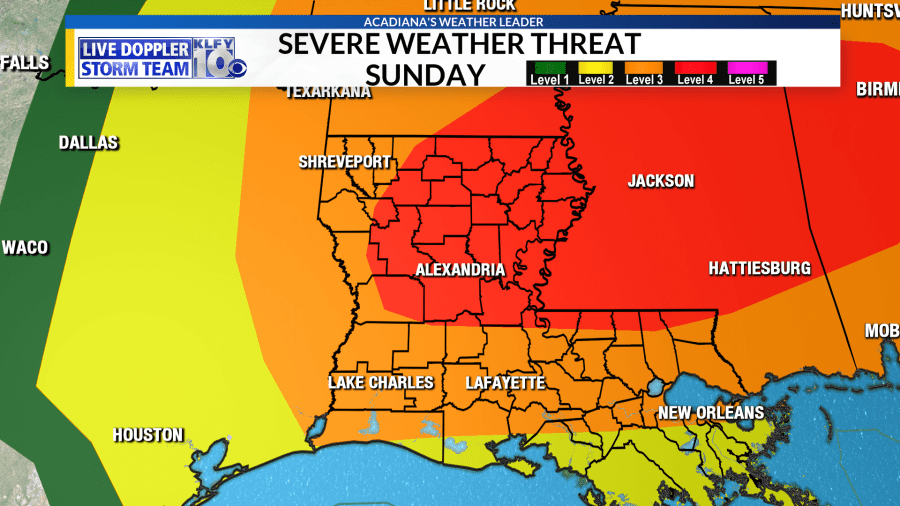
I went through the science of it for anyone interested, but bottom line is most of Acadiana is hatched in for an “Enhanced” Risk tomorrow, which is a level 3 out of 5 on the scale of severity. All modes of severe weather is possible with damaging winds, hail, and tornadoes. Stronger tornadoes could be possible further northward towards central Louisiana, Mississippi, and Alabama, where a “Moderate” risk has been put in place, a level 4 out of 5 on the severity scale.
Timing looks to be late morning through late afternoon. Let’s hope the “cap” in the atmosphere can limit storm development and the severe weather potential across Acadiana. Looking at similar storms in the past, most of the severe weather events were further north, so hopefully for Acadiana we can dodge a bullet again. It’s always good to be prepared!
I always stress not to panic during bad weather in Louisiana. Just take the few precautions necessary to keep yourself safe. For instance, mobile homes, especially ones not anchored down are more prone to flipping or being damaged in 60-70 mph winds. For this reason, it’s best to stay with a friend, neighbor, or family member that has more sturdy shelter. Large trees, especially oak, can fall in high winds. If your home is surrounded by trees that worry you, the same advice applies. The obvious one, of course, is not to travel in warned areas if possible.
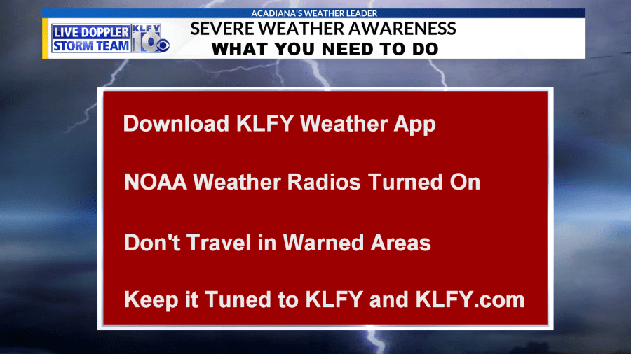
Keep it tuned to KLFY through the day tomorrow as we’ll be providing updates as needed.
Download the KLFY Weather App for free by clicking here.


