A TORNADO WATCH remains in effect for western areas of Acadiana through 11 a.m. This includes the parishes of Acadia, Allen, Evangeline, and Vermilion.
A TORNADO WATCH means that the atmosphere is conducive for the development of rotation in storms.
Wind shear remains strong in the lower-levels of the atmosphere as winds are getting stronger and turning with height. This is supportive of storms producing damaging winds and isolated tornadoes. Prime time to see storms will be from 9am-3pm as the line of storms could slow down as it enters Acadiana.

Of note, the surface low pressure, that is responsible for the howling winds, will begin to move quickly north-northeast through the morning hours. This could diminish severe weather parameters across the area through the afternoon as the low pressure moves further away from Acadiana. Let’s hope that’s the case as storms move through later today.
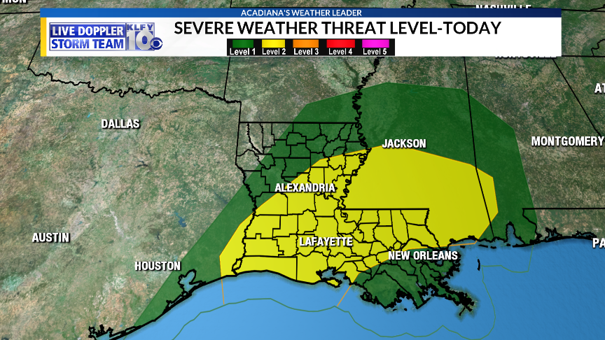
As it stands, we are under a Level 2 out of 5 risk for severe storms today, with damaging winds and isolated tornadoes being the primary hazards.
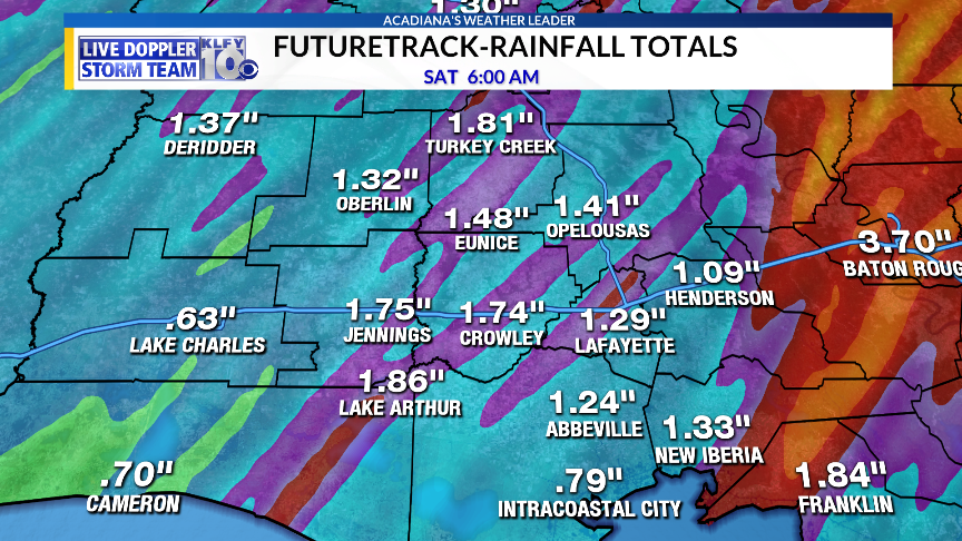
Some heavier rainfall could be possible as well with the possibility of 1-3 inches of rain through tonight, especially over eastern areas of Acadiana.
Hopefully, the line of storms progresses through the area rather quickly, diminishing the heavier rainfall threat.
~Meteorologist Trevor Sonnier
