
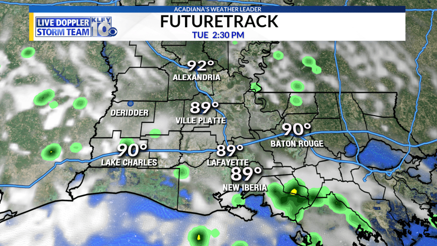
We will see a small chance of rain each day for the rest of the week with highs in the low to mid 90s. Rain chances will be a little higher over the weekend, especially Sunday. Highs over the weekend will be in the upper 80s. We might see a cold front move through in 10 to 14 days.

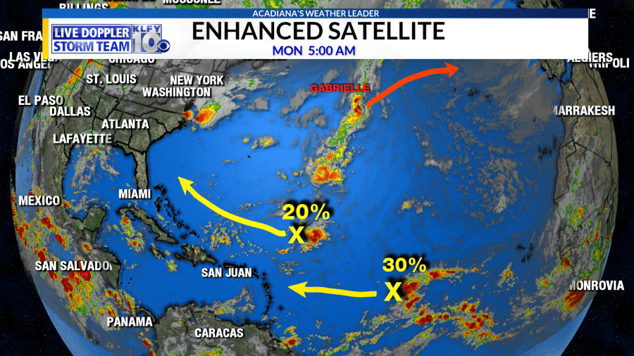
Checking on the tropics…Activity has settled down across the Atlantic Basin. Hurricane Dorian finally dissipated over the weekend. Tropical Storm Gabrielle continues to spin out in the northern Atlantic as it heads east, away from any land. The National Hurricane Center is tracking two separate disturbances with a low threat for development in the southeastern parts of the Atlantic Ocean. The disturbance closes to land is located just north of the Caribbean Sea as it heads towards the Bahamas. Currently, this has a 20% chance for tropical development. Further east is a tropical wave with a 30% chance for tropical development as it heads towards the Caribbean Sea. I think this wave will be one to watch closely for the next 1-2 weeks. The next name on the list is Humberto.


