A Flash Flood Watch is in effect across all of Acadiana until 7:00pm Thursday, June 6th. Overall, Acadiana will receive around 3-5″ inches of rain but there will be areas that see 6-10″ inches of rainfall or more. The drier weather over the past two weeks will help with absorbing the initial rains but with the greater threat for heavy rains coming tonight and Thursday for Acadiana, flash flooding will be a threat that we will need to monitor for throughout the area.
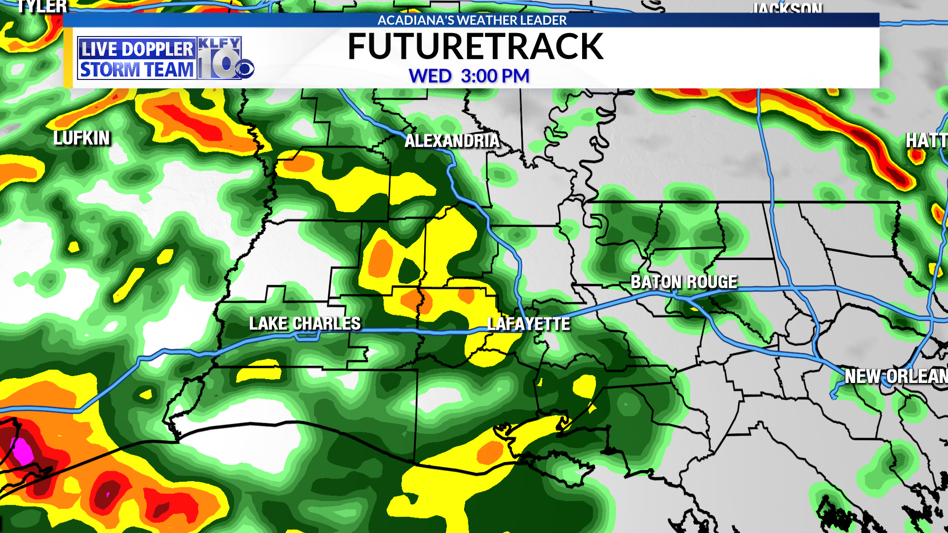
Rainfall will be on and off today with waves of showers and storms. The heaviest rains on this Wednesday should remain in Texas and the very western parts of the state. Starting tonight and going into Thursday morning, the more torrential rains should push eastward into more of Acadiana increasing the threat for flash flooding in our viewing area. The severe threat should remain minimal but some gusty winds are expected. Minor coastal flooding is also expected for the next few days with the strong south winds and high tides.
The new KLFY Weather App is here.
It’s the most advanced weather app you can have on your phone. It will alert you to severe weather where ever you are in the world. With it’s GEO Targeting tools, it will give you the latest hour by hour forecasts and 10 days forecasts for where you are at the moment.
To find out more what it can do, click here.
It’s easy to download the new KLFY Weather App.
If you have an Android phone, you can download it at the Google store by clicking here.
If you have an Apple phone, can you download it at the Apple Store by clicking here.
For more stories like this that matter to you, click here to download the News 10 app for free.
Watch live newscasts, get breaking news and sign up for push alerts – download now


