
Hurricane season is now upon us and things have already heated up in the tropics with two named systems having already occurred. Long-range models are hinting at the possibility of deep tropical moisture building up in the southern Gulf/southwestern Caribbean in 6-10 days. This may be the next area that needs to be monitored for tropical cyclone formation.
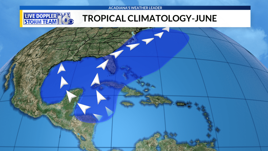
A monsoonal trough sets up across Central America this time of year and many times this can serve as a hot-bed for tropical systems early in the season. This area has consistently lower pressures than the rest of the basin, which leads to rising motion and possible tropical cyclone formation if conditions are right.
Both the GFS and European models have a low pressure area developing in this region within 6-10 days, possibly moving into the southern Gulf in about 8-10 days. While I am giving this a mention, I do have to stress models in the long-term can be unreliable. This is especially true dealing with this monsoonal trough early in the season. The GFS model is notorious for spitting out tropical cyclones off of this trough, tropical cyclones that never materialize. For this reason, and adding in the long-range of the predictions, we have to view this with some skepticism. Remember, models are somewhat reliable in the 7-9 day range, but become exceedingly unreliable when the projection is 10 days out and further.

I wouldn’t worry too much about this at this point, but deep tropical moisture could begin to stream northward into the area by the end of next week. If any tropical formation would occur, it would most likely be by the end of next week and heading into next weekend.
Climatology does support this area as favored for tropical cyclone formation, so we will keep an eye on things. Most of the cyclones that do form this early in the season are mostly large and disorganized tropical storms, which mostly become rain-makers.
We’ll continue to monitor this through the week ahead!


