It’s now August and the tropics are responding right on cue. It has been an active season so far with already 5 names being taken off the list, but it appears more tropical development could occur within the next 5-7 days.
EASTERN ATLANTIC DISTURBANCE

A strong tropical wave has emerged off of Africa and is steadily getting better organized. The wave has built high pressure aloft, which helps to isolated the storm from the effects of wind shear. An upper-level trough, located to the north of the disturbance, is also helping to ventilate the system. This wave should have no problem getting better organized and a tropical depression or storm could develop within the next 24-48 hours.
Thereafter, a building high pressure system to its north should keep the system moving westward. It could approach the Lesser Antilles Islands in about 5-6 days. It is too far out in the forecast to know what could become of the system after this time frame. Long range models keep it moving westward, in the general vicinity of the Bahamas, but model runs will continue to be analyzed.
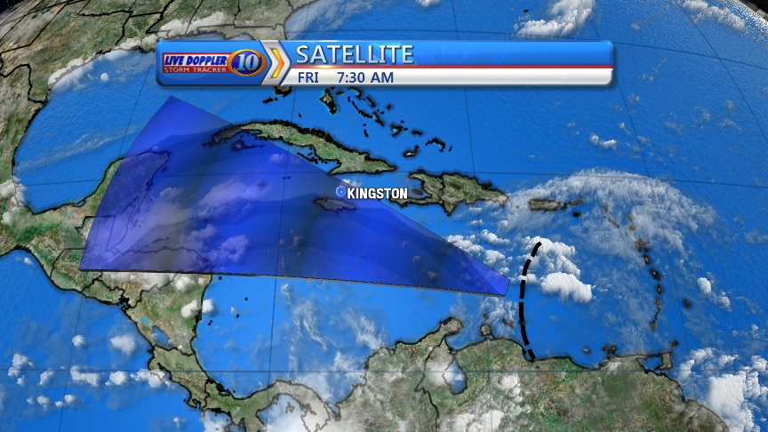
EASTERN CARIBBEAN DISTURBANCE

Tropical wave, currently located in the eastern Caribbean, still has a ways to go in terms of organization. Models have it continuing to move westward, while staying weak due to the impact of westerly shear. The environment could become more favorable for slow development in about 3-4 days, when the system is across the western Caribbean. An upper-level trough will be positioned across the eastern Gulf at this time, which may help to ventilate the area and help wind shear to lower around the disturbance. Models are starting to hint at this idea, with some models showing some modest development once the disturbance crosses the Yucatan Peninsula and enters the southwestern Gulf by the middle parts of next week.
I do not usually like to talk about track beyond the seven day time frame, so I won’t spend too much time on it. However, a track towards Mexico or south Texas could be possible with anything that comes of this disturbance. There could be a trough, somewhere across the southeastern U.S., capable of lifting the disturbance more northward though, so it will still have to be watched through the next few days. Remember, storm tracks 6-8 days out are typically not the best.
The next two names on the list would be Franklin and Gert.
~Meteorologist Trevor Sonnier
