
A front will slip through the area tonight, leading to mostly clear skies and a drier airmass coming in from the north. This will push temperatures into the mid-50s by tomorrow morning.
Tomorrow afternoon, temperatures rising into the lower 70s under mostly sunny skies. North winds will persist through the day behind the front.
By Tuesday, our next weather maker begins to take shape across the lower-plains. This will switch our winds out of the south and also increase winds through the day. A slight chance for severe weather is possible with storms across the northern portions of the state and across Arkansas. With the exception of a few showers, most of the rain holds off for Acadiana through Tuesday. This front will make it through the area on Wednesday, leading to a round of storms.

The severe weather threat won’t be there any longer, however, as the dynamics with this system will be quickly racing to the east. A cold front is expected to briefly clear the area on Wednesday.
This frontal passage will be short-lived, as south flow will return for Thanksgiving Day, bringing the front back northward as a warm front. I have increased rain chances from 20% to 30% during the day as the warm front lifts northward. This rain shouldn’t be heavy, but light showers–coupled with mostly cloudy skies–could be possible. This will also be true for Friday as the warm front stalls across the northern portions of the state.
By Saturday, a strong upper-level system will move across the country. This will swing a strong front through the area Saturday night and Sunday. The exact timing of these fronts is always difficult, but it appears storms will be in the forecast through the day on Saturday and into the early hours of Sunday.
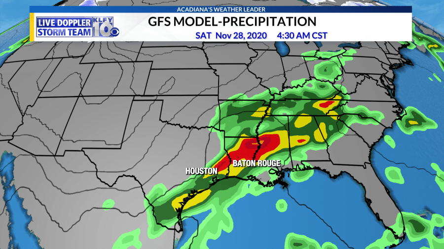
Still too early to know if severe weather will be an issue with this system, but as of now, it appears any chance for severe weather would be low, given the orientation of the setup. A quick couple inches of rainfall could be possible during the Saturday-Sunday timeframe.
Behind this system, much colder air works down from the north. Long-range model guidance advertises the possibility of highs in the 50s next Monday and Tuesday and lows possibly in the 30s! This would be our first, significant, cold front of this early cold season.


