
We saw numerous storms out there this afternoon, moving from northwest-to-southeast across Acadiana. Rain-cooled air kept us in the lower 80s throughout most of the day.
A few more storms could be possible through the overnight hours, but activity will be widely scattered in nature.
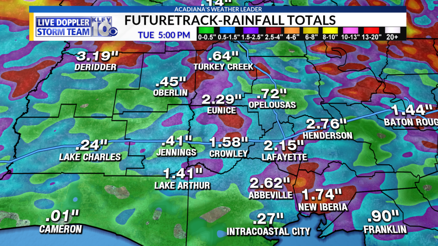
For tomorrow, an upper-level low/weakness will continue to reside overhead. This gives us the cold air aloft, the atmospheric instability, and the atmospheric lift–all the ingredients needed for widespread storm development. Moisture levels will still be very high tomorrow, so storms could be efficient rain-producers, possibly dumping 2-3 inches of rainfall per hour.
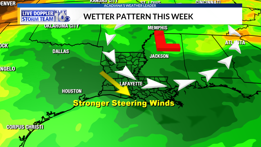
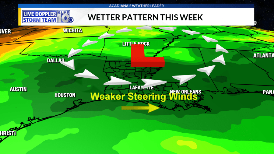
One subtle difference we’ll have to account for tomorrow is a change in the steering winds. Winds aloft were out of the northwest today, allowing the storms to progress southeastward pretty quickly this afternoon. Even so, some areas still picked up 2-4 inches of rainfall through the day today. Tomorrow, the flow could become more west-to-east as we will be on the south side of this upper-level low. Winds could also be a bit weaker than they were today. This means storms could move slower and possibly train over some of the same areas. For this reason, we’ll have to more closely watch the possibility of flash flooding in isolated areas throughout the day tomorrow.
Rain chances diminish by Wednesday and through the weekend. A ridge of high pressure will be building in from the west, which will lead to hotter temperatures. We could be talking mid-90s by Friday, Saturday and Sunday!


