
In the near-term, mild and muggy conditions continuing as I’m expecting highs in the lower 90s for your Friday with a few isolated storms popping up with the heat of the day. Feels like temperatures once again exceeding 100 degrees.
By the weekend, a mid-level disturbance will work across the area, increasing atmospheric instability and moisture. This will increase daily storm coverage starting Saturday and continuing through Sunday. Highs will be near 90 degrees each afternoon.
By the early parts of next week, a trough will begin to dig down into the eastern U.S. This will push a surface cool front into the heartland, giving them much needed relief from the heat. As the trough digs south, this front will continue southward through Monday, moving close to Acadiana on Tuesday.
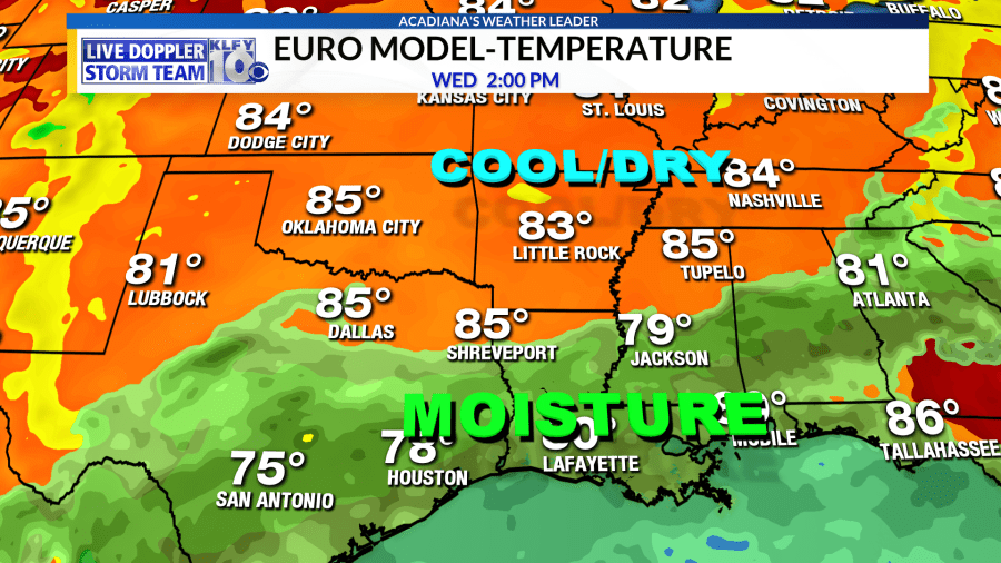
This is when models diverge as the European model stalls the front over Acadiana, keeping high rain chances for us through Tuesday, Wednesday, and Thursday.
The GFS model, however, has storms Tuesday and later moves the front southward into the northern Gulf for Wednesday and Thursday. The GFS scenario would be awesome as drier and slightly cooler air would work southward into Acadiana. In fact, the GFS model is showing middle 60s heading through Wednesday morning with temperatures only rebounding into the low-mid 80s Wednesday afternoon.

Yes, this would be a rare treat in the heart of summer, but the GFS model is notorious for being too progressive with fronts and the upper-air pattern. My forecast closely resembles the European model, which I believe is a little more realistic in this scenario. I wouldn’t mind getting proven wrong though!
~Meteorologist Trevor Sonnier
