Today was a beautiful day across the area, but unfortunately, the nice weather will be short-lived.
Starting tomorrow, deeper tropical moisture will begin to surge northward into the area. Clouds will increase through the day with heavier rainfall beginning to develop near the coast later tomorrow afternoon and tomorrow night.
We will have two waves of energy move through the area through the week. The first wave will move through tomorrow and Monday, dumping heavy rainfall in spots.
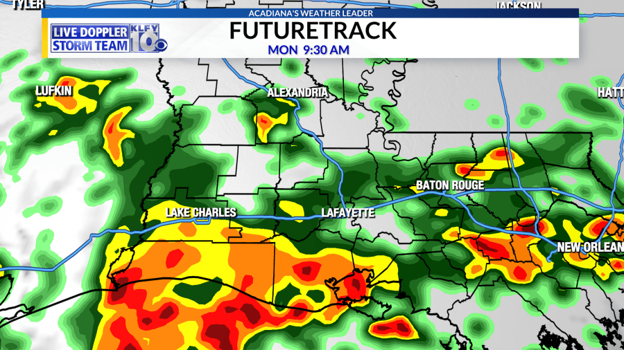
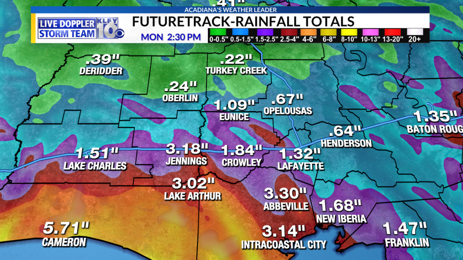
High-resolution models show the possibility of 3-6 inches of rainfall through the day on Monday, mainly along and south of I-10.
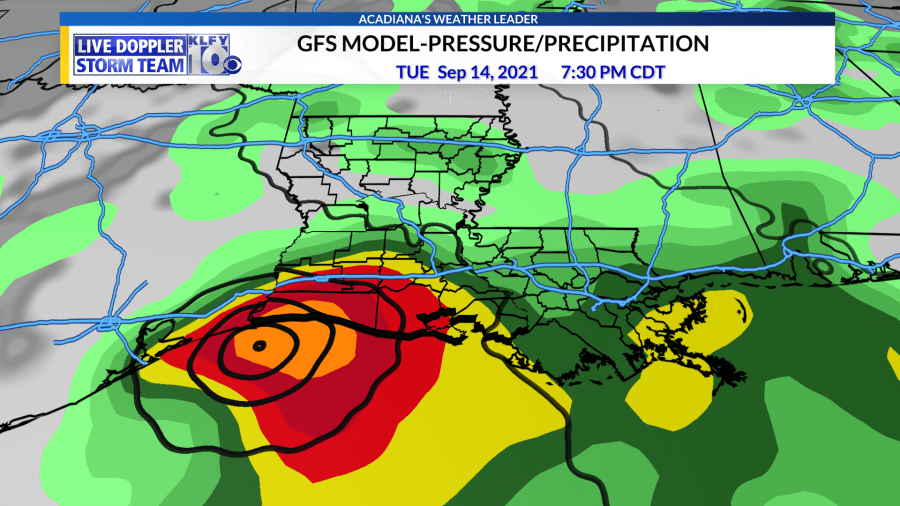
Thereafter, a second wave will move in by Tuesday and Wednesday. This is a low-pressure area, which is also being monitored by the National Hurricane Center for tropical development. It currently has a high chance for tropical development within the next five days with a tropical depression or tropical storm possible.
The latest GFS model has a tropical storm moving into southeastern Texas/southwestern Louisiana by Tuesday night and Wednesday. Energy will be moving in starting tomorrow, leading to the possibility of 3-6 inches of rainfall through the day on Monday. Thereafter, this low pressure, regardless of development, will move across the area, producing another round of heavier rainfall. Near and just to the east of the low, rainfall totals could be very high with rain rates of 4-8 inches in a 12-to-24 hour period. Cumulatively, rainfall totals of 5-10 inches could be possible across the area through next Thursday with isolated higher amounts. This is the type of pattern where both the flashing flooding and areal flooding potential will have to be monitored. The European model also shows high rainfall totals, but to a lesser degree than the GFS model. European model reflects a good soaking, but much more manageable rainfall totals, especially over a five-to-seven day period.
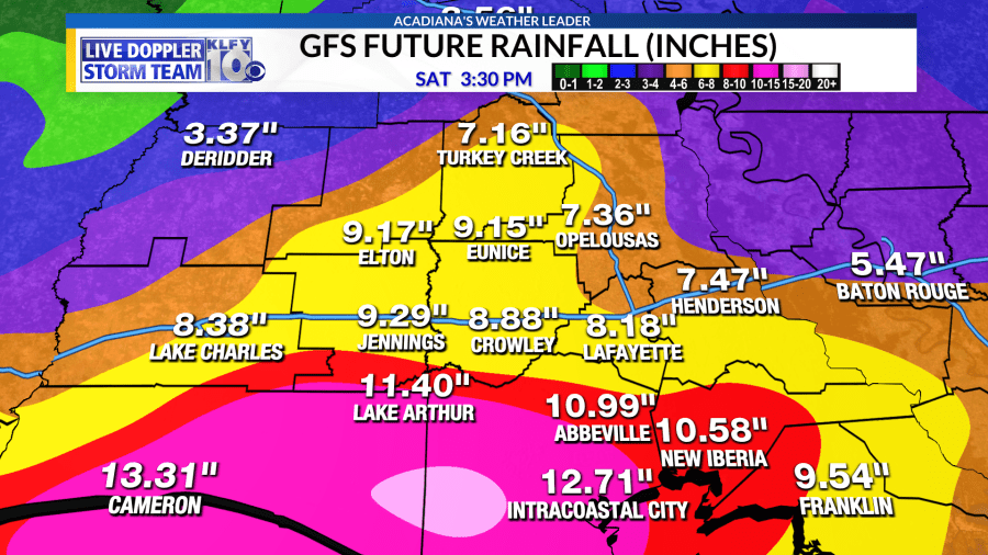
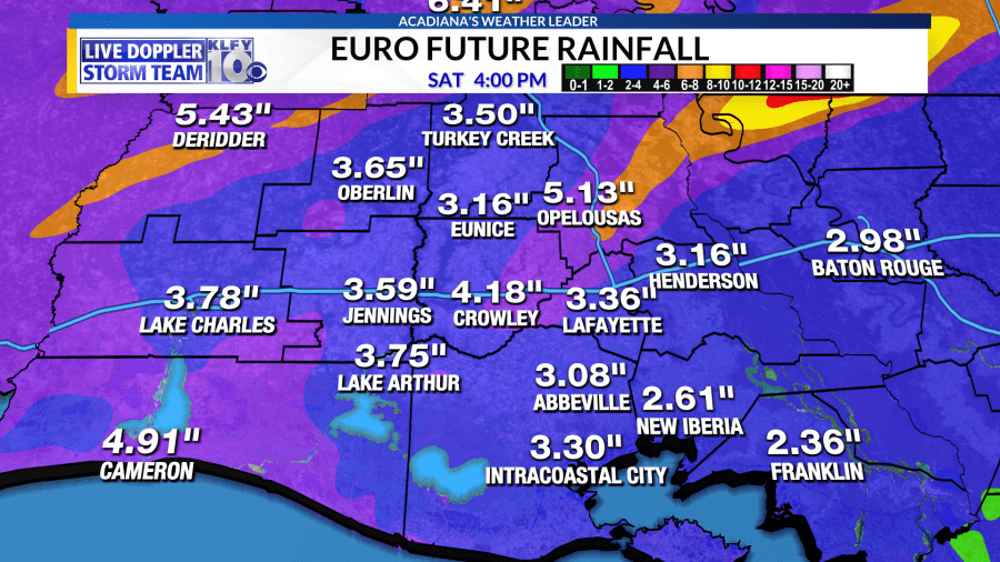
My forecast is calling for the possibility of 5-10 inches, especially south of I-10 and areas east of where the tropical low moves ashore. Hopefully, the low continues to progress inland through Thursday and Friday, decreasing rain chances. Any stalling motion to our north would lead to a prolonged heavier rainfall threat through the end of the week.


