
We’ve stayed dry through today with most of the storms across eastern Texas and the northern portions of the state. That will be changing later tonight as storms work into central parts of the state. Thereafter, high-resolution models have storms becoming linear, making a move towards Acadiana overnight and through early tomorrow morning. Some models advertise the possibility of some heavier rainfall with the possibility of 2-4 inches possible as these storms could dump rainfall rates of 2-2.5 inches per hour.
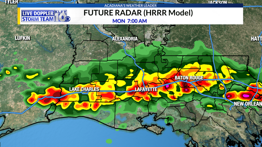
There is a severe weather chance across central and northern portions of the state tonight. Storms will be losing some of their strength as they work down to the south overnight, but it wouldn’t surprise me if these storms have a gusty wind component to them, especially if storms come in as a linear complex as some high-resolution models advertise.

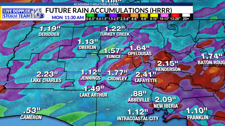
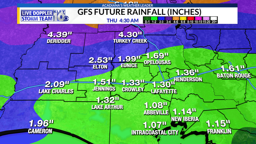
Storms could become more scattered tomorrow afternoon and tomorrow night as the atmosphere will take some time to re-energize. A slow-moving front will position itself just north of the area through Tuesday and Wednesday. Meanwhile, subtle upper-level impulses and an atmosphere loaded with moisture will support widespread rainfall both Tuesday and Wednesday. Longer range models show the possibility of 2-4 inches of rainfall across some parts of Acadiana through Thursday morning, with the possibility of isolated higher amounts especially across central parts of the state. Of course, we always have to watch for the possibility of flash flooding with these systems, but rainfall totals like these over a 3-day period wouldn’t constitute any type of major flooding event, but rather a good soaking.
We look to clear out by Thursday and Friday with sunshine returning!


