
The National Hurricane Center continues to issue advisories on Potential Tropical Cyclone 16 in the central Gulf of Mexico.
PTC 16 is expected to quickly move northeast, further organizing and strengthening into Tropical Storm Nestor today. By Saturday, this disturbance should reach the northeastern Gulf where it will develop further as it interacts with a frontal boundary. Regardless of development, heavy showers and storms will spread into the eastern parts of the Gulf Coast, mainly the panhandle of Florida. Models continue to show this disturbance staying well east of Acadiana.
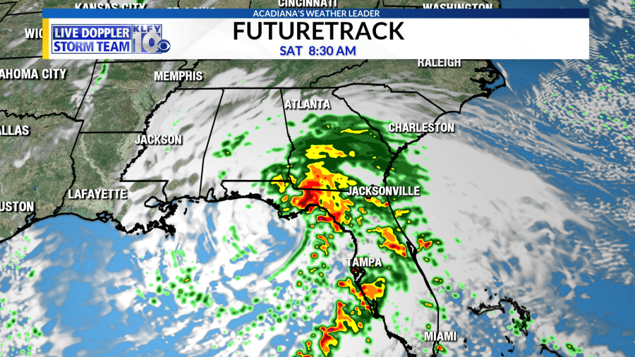
We expect little to no impacts from this disturbance. This system will be monitored closely through the weekend. The next name on the list are Nestor.


