Hurricane Ida continues to strengthen as it moves toward land. The 10 p.m. update shows that Ida is expected to reach major hurricane status, strengthening to possibly a Category 3 by the time it makes landfall.
Hurricane Ida is strengthening as it moves northwest this morning located just south of Cuba. The 10 p.m. Update from the National Hurricane Center forecast shows Ida strengthening into a major hurricane (Category 4) Sunday before landfall near Terrebonne/St. Mary Parish in southeast Louisiana late Sunday. Acadiana remains on a fine line for the severity of impacts Ida could bring to the area.

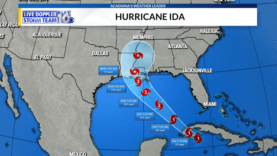

Hurricane Watches and Storm Surge Watches have been issued across the coastal parishes of the state. More watches and then warnings will more than likely be issued today or tomorrow.


Tropical models are mostly in agreement with the NHC Cone, although they are clustered slightly more west at landfall. A track any further west will significantly raise the severity of impacts in Acadiana.


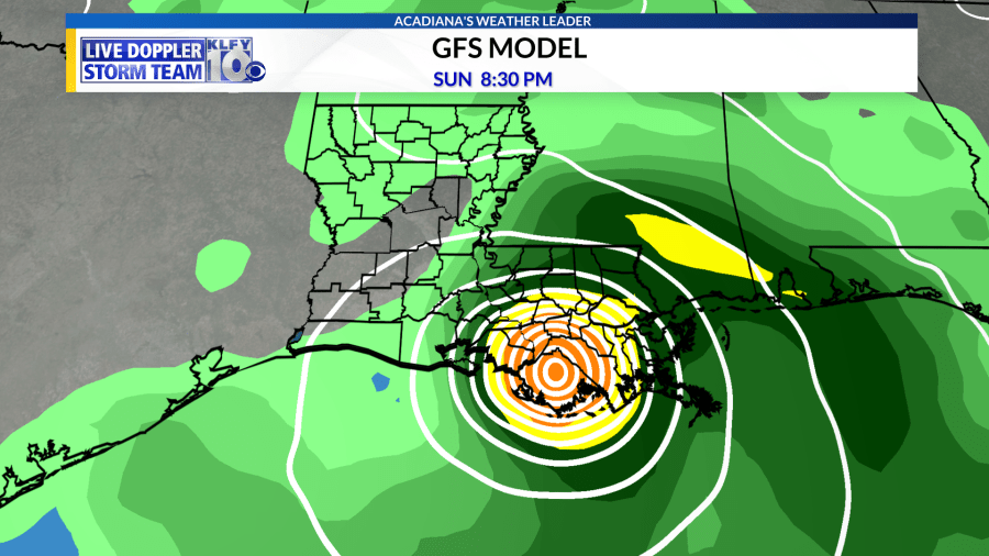
In the last few years, the GFS has outperformed most models in regards to the location of landfall for a tropical system. The Friday morning run for the GFS shows Ida making landfall across Terrebonne Parish Sunday evening.
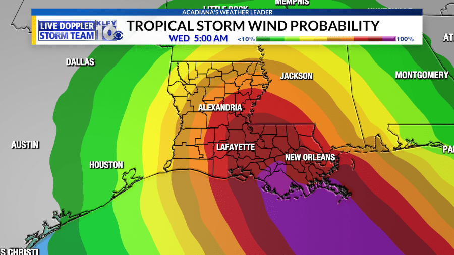
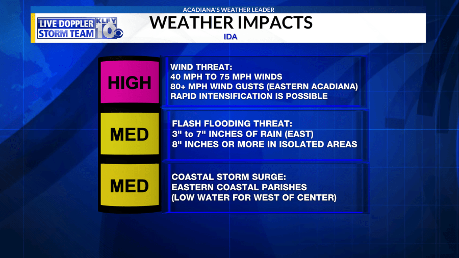
The eastern side or right side of Ida will bring the most significant impacts when it comes to flooding rains, tornadoes, and storm surge. The western side of the system will still have very strong winds in excess of 80 mph with gusts possibly around 100 mph or more. Regardless, much of Acadiana has a high probability of seeing tropical storm strength winds from 39 to 73 mph.

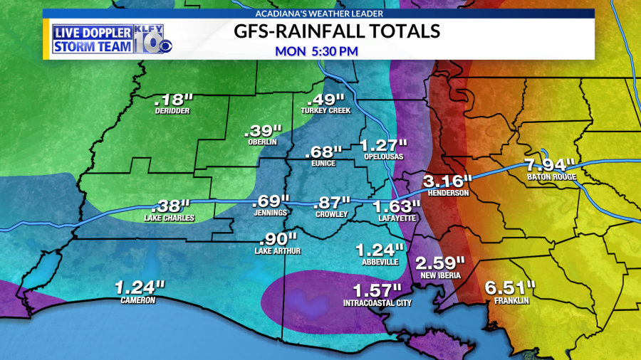
As mentioned before, the eastern side will have the highest rainfall totals with the system where areas could see over 10″ inches of rain. Looking at the current forecast from the GFS, those high rainfall totals will be east of Acadiana but you can see how close of a threat this will be to our area.
Here are the impacts expected for Acadiana, these will need to be adjusted as we fine-tune the exact path at landfall. Central and especially eastern Acadiana need to be on high alert for any shifts west with the track.


