
Wednesday is starting off milder for Acadiana with no dense fog as temperatures sit in the low to mid-50s. The afternoon will turn warm, breezy, and cloudy with highs in the lower 70s. Scattered rain is possible during the afternoon before we see a line of storms move into Acadiana this evening.
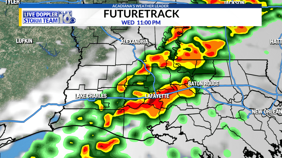
A strong cold front is expected to move through Acadiana this evening. A line of thunderstorms should form along this front and will roll through our area between 6:00pm to Midnight.


There is a low threat for severe weather within this line of storms. Damaging winds and/or a few tornadoes are the primary threats given the setup within the atmosphere. Large, damaging hail is a possibility too. The Storm Prediction Center has increased its threat outlook to the “Slight Risk” category, which is considered a 2 out of 5 for the likelihood of severe weather within the risk area.
Now is the time to download the KLFY Weather App. It is the most advanced weather app you can have on your phone.

It will alert you to severe weather where ever you are in the world. With it’s GEO Targeting tools, it will give you the latest hour by hour forecasts and 10 days forecasts for where you are at the moment.
If you have an Android phone, you can download it at the Google store by clicking here.
If you have an Apple phone, can you download it at the Apple Store by clicking here.


