
A mostly sunny sky will be featured for today with highs climbing into the 70s. This is due to southeast winds becoming established this afternoon.
Not as cool tonight as readings dip only into the lower 50s.
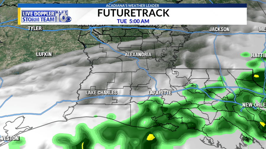
Even warmer for tomorrow with highs climbing into the upper 70s. Clouds will be increasing through the day as the front approaches the northwestern portions of the state and southeastern Texas tomorrow afternoon. Rain and an embedded thunderstorm could move into Acadiana later tomorrow evening and tomorrow night as the front draws closer. The main front looks to work through the area very late tomorrow night and into Tuesday morning.
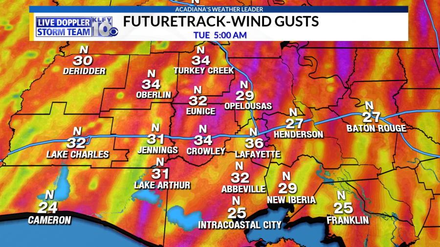
Temperatures will be falling very quickly, likely by some 25 degrees, as the immediate front passes your location. Winds will be howling out of the north behind the front. Inland areas could see sustained winds of 20-30 mph with gusts of 35 mph. Hunker down offshore as winds could be in the 30-40 mph range with higher gusts! WIND ADVISORIES may be issued for tomorrow night.

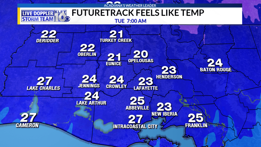
This will also push wind chill values into the lower 20s by Tuesday morning!
Some moisture could linger behind the front Tuesday morning as cold air drives to the south. A combination of cold air advection and wet-bulbing (air cooling due to rain) could sink temperatures into the 35-37 degree range.
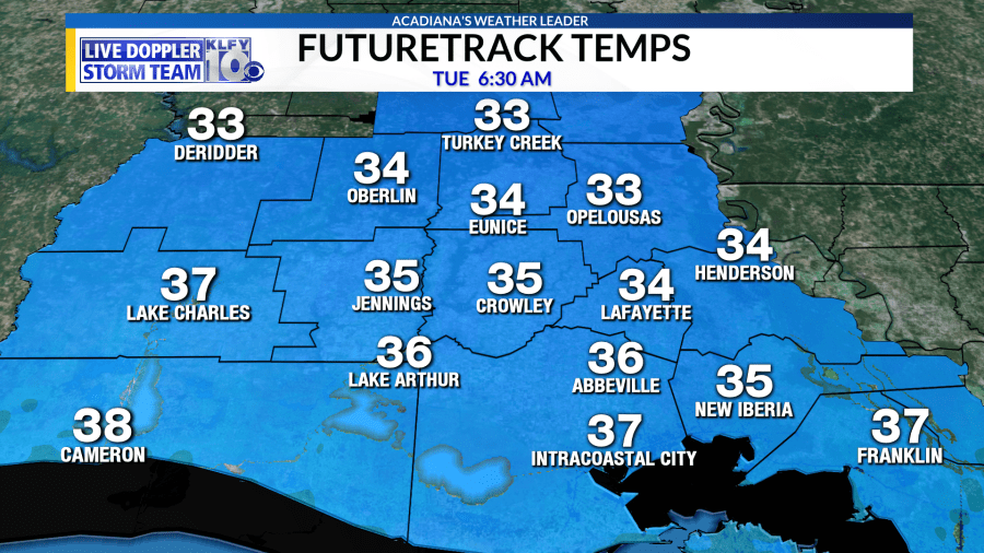
Of course, this is well too warm for any type of winter precipitation, although a sleet pellet or two could be possible north of Highway 190. The only potential concern would be across the central parts of the state, because if temperatures can get to the freezing mark, even if rain has ended, sometimes water left on bridges and overpasses could freeze and form a black-ice type situation. It may be a good idea to use caution on the roadways across central parts of the state Tuesday morning.
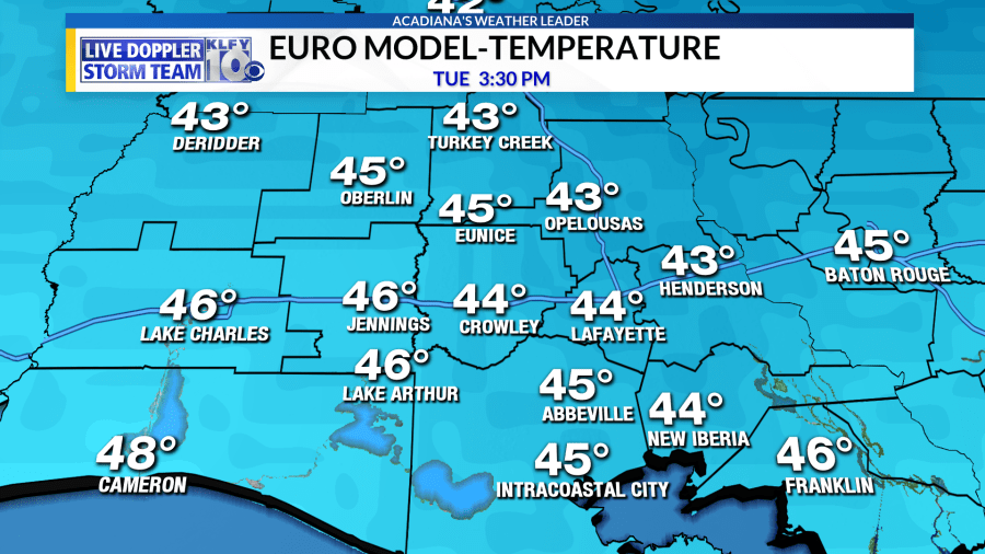
Temperatures not warming up much Tuesday afternoon, only climbing into the low-mid 40s. Wind chills likely staying in the 30s throughout the day.
With calming winds and clear skies, temperatures will really plummet Wednesday morning. Most of Acadiana will see the first freeze of this Fall season with overnight lows in the 27-30 degree range. Middle 20s could be possible across central parts of the state.

This is not pipe-busting cold, but make sure to cover up sensitive vegetation and make sure the pets have a warm place to stay!
A slow moderating trend for the end of the week as temperatures get back into the 50s Thursday and Friday and into the 60s by next weekend!


