Mostly cloudy skies and warm temperatures expected through the next 24 hours as warm, moist air continues to surge into the area. Southeast winds will increase tomorrow into the 10-20 mph range as the pressure gradient increases across the area. A few showers could be possible through the day as atmospheric lift begins to increase. The majority of the storms and heaviest rainfall, however, should stay across eastern Texas through the day tomorrow. An upper-level low pressure system will approach the region from the west. This will help a surface low pressure to develop across south-central Texas tomorrow night.
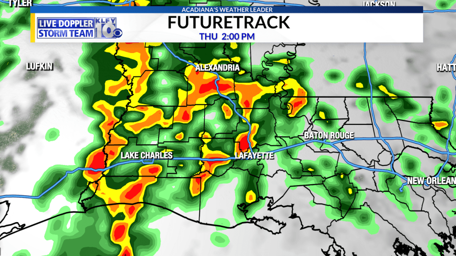
This low pressure will continue to strengthen while moving northbound during the day on Thursday. Meanwhile, a surface cold front will begin to approach Acadiana. A combination of this surface low pressure/upper-level low will create an atmospheric environment indicative of severe weather including high wind shear and a sharp temperature drop with height. Instability will not be maxed out with this event, but wind shear will be adequate enough for storms to gain rotation, leading to the possibility of a damaging wind and tornado threat on Thursday. The Storm Prediction Center (SPC) has Acadiana hatched in for a Slight (Level 2) risk of severe storms. It would not surprise me, however, to see this upgraded to an Enhanced (Level 3) risk tomorrow. The window to see storms will be primarily from late morning Thursday until late evening.
Hopefully, most of the heaviest rainfall will be moving out of the area before New Years Eve festivities.
The front will move through the area Thursday night and Friday, with slightly cooler air setting up by New Years Day and the following weekend!


